Status: Members Only |
|
|---|---|
| Site Latitude: N51.675372 | Height ASL Meters: 472m |
| Site Longitude:W003.056106 | Height ASL Feet: 1,550ft |
| Wind Direction: SSE - S | Height Top to Bottom Meters: 120m |
| Best Direction: SSE | Height Top to Bottom Feet: 390ft |
| Minimum BHPA Rating Hang Gliding: BHPA P rating | Member status: Members Only |
| Minimum BHPA Rating Paragliding: BHPA P rating | OS Grid Reference and Prefix: ST 268 979 |
Latitude: N51.676539
Longitude: W003.046337
You can take the Mountain Air road either from Pontypool or Cwmbran.
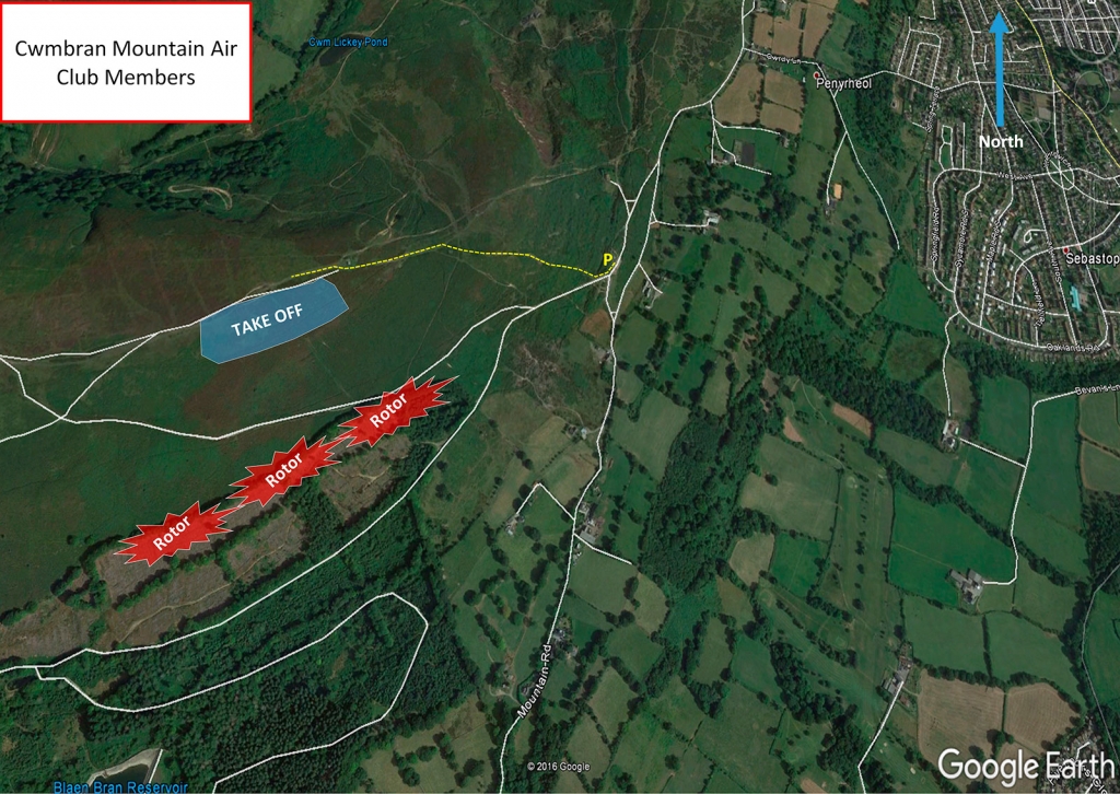
If you’re coming from Cwmbran head towards Siloam Baptist Church, Upper Cwmbran, NP44 5AG. Get on the Mountain Air Road, follow it up the mountain until the road flattens out you will then see a turning on the left leading to a large car park. You can then walk up the mountain from there heading towards the TV mast on top of the mountain. Walk up time abound 15 minutes.
Park in the parking areas, Lat/Long above.
Take-off
Walk past TV mast where you will find plenty of places to take off.
Landing
The top landing area is a little tricky for hang gliders and needs careful planning. Watch out for the mast. Paragliders will find slope landing difficult because of the steepness of the slope, the bracken cover, and the trees at the bottom, which cause significant rotor. Bottom landing is possible on scrub/common land to the SW of the car park, but note that there is a high voltage cable on the other side of the road, so overshooting is not an option. Where possible, pilots may find it more sensible to land on the shoulder of the hill, just behind the path that they have walked up to take off, taking care on the approach not to go too far back into wind shadow from the front of the hill.
Thanks to Richard Harding for this re-wording
Top Landing General
South East Wales sites often have very large, undefined take off and top landing areas, which may change position according to conditions. To avoid the potential for collision, pilots making a top landing should keep well away from gliders taking off, who may in some cases have limited visibility.
Flying
During the first few hundred feet of height gain, watch out for turbulence from the trees below ridge level. In strong thermic conditions the air can become rough there due to the tree line at the bottom of the slope.
Hazards
There is a clay pigeon shooting range behind the Mountain Air Inn on Sundays, look for the red flag.
None.
SEW Members Only Site. You must have in date membership subscription to SEWHGPGC. SEW helmet sticker to be stuck on your helmet at all times.
TBC.
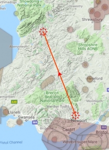
Rich Harding flew 110.5 km on his Ozone Zeno on 07 May 2019. Click here to see his flight path.
All rights belong to Google Inc. SEWHGPGC is a nonprofit making organisation.
If you require further advice about a particular SEWHGPGC site please contact a Club Coach. Please report all accidents to The Club Safety & Training Officer Steve Millson and the BHPA. Please visit the BHPA for the most current Incident Report Form.
This document is a guide only.
We advise that anyone Hang Gliding and Paragliding conduct a dynamic risk assessment prior to flying any site. This should be continuously re-assessed due to the changeable conditions of the outdoor environment.
All individuals are advised to take the following into account when making their dynamic risk assessment:
Paragliding and Hang Gliding are dangerous sports that can cause serious injury including bodily harm, paralysis and death. Flying SEW sites is undertaken with the full knowledge that Paragliding and Hang Gliding involves such risks. As the pilot you take exclusive responsibility for all risks associated with your part taking in the sport.
Any liability claims towards the club are excluded.
If you are not sure. DO NOT FLY.
In the Mountains/Rivers/Lakes
Dial 999/112 and ask for the Police and then Mountain Rescue. If you are away from the road side then dial 999/112 and ask for the Police and then Mountain Rescue explaining your circumstances. If you cannot make voice calls, you can now contact the 999 Emergency Services by SMS. NB you must register this prior to an emergency.
In an emergency 999 need to know:
Who is Calling?
Your name and mobile number.
What?
Briefly, what is the problem, including the state of the casualty. Ensure you use the buzzword Fall From Height
and Remote Location.
Where?
Mynydd Twyn-glas Mountain, 1.5km NW of Upper Cwmbran near the TV antenna.
