Status: Open |
|
|---|---|
| Site Latitude: N51.603811 | Height ASL Meters: 366m |
| Site Longitude:W003.122369 | Height ASL Feet: 1200ft |
| Wind Direction: SE-S and NE | Height Top to Bottom Meters: 300m |
| Best Direction: S and NE | Height Top to Bottom Feet: 1000ft |
| Minimum BHPA Rating Hang Gliding: BHPA P rating | Member status: Members Only |
| Minimum BHPA Rating Paragliding: BHPA P rating | OS Grid Reference and Prefix: ST 223 900 |
Note, access road was reported blocked in May 2025. Please report to the committee if you visit and have more detailed information.
For vehicular access to take-off, take the A467 from Newport or Brynmawr. Then take the B4591 to Crosskeys. Turn right at the first set of traffic lights, then second left into Cobden St. Continue along this street until you reach the sports fields, then turn right into Blackvein Rd. Follow this narrow road up the steep hill and over the cattle grid. Half a mile later, turn left through the gate and follow the track to take- off.
If the gate is locked please contact Mr Sutor at the adjacent farm. For foot access to take-off follow the A468 from Newport or Caerphilly and minor roads from Lower Machen.
Note, access road was reported blocked in May 2025. Please report to the committee if you visit and have more detailed information.
Park at the summit itself (just before the transmitter mast) or just off the road (before or after the bend) on the way to the summit of Mynydd Machen. Do not obstruct the track or drive onto the common. The track may be quite rutted and bumpy.
Alternatively park on the east side of the mountain and walk up (see map).
Take-off
Access is a carry up on foot from the viewpoint car park on the east side, or a short carry from the parking areas by the transmitter.
NE side – This is very steep and only occasionally little flown by hang gliders, it is far more suited to paragliders.
SE SIDE CLOSED – The south-east take-off (by the mast) is now dangerous to take off from – due to the trees out in front causing rotor. The trees are gradually being removed from the hill. When the trees have been cleared in front of the south and south-east take-off the situation will be reviewed. Until then you are advised not to fly in any wind direction with tall trees up wind of take-off due to the turbulence they create and the glide required to clear them.
Slag heap (south) – this is possible to fly off in a southerly direction. Beware this is a spine back so if there is any change of being blown back then do not fly. Be careful of old metal parts poking out of the ground. Do not fly if you do not think you can land immediately in front of the slag heap (avoiding farmer’s fields).
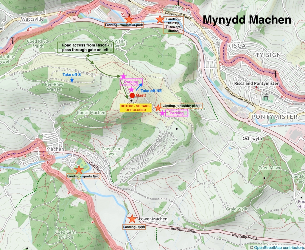
The SE take-off looking towards the quarry. Note the tall trees which will give off significant turbulence in increasing wind speeds.
Landing
Top land on the flat ground alongside the transmitter mast.
NE side – Shoulder landings are possible by the viewpoint car park which saves a long walk up from the bottom. Bottom landings are possible in Risca – in Waunfawr park or the fields next to the firestation (see map). Make sure you have a good enough glide to get there.
SE – The SE side of the mountain is closed as take-off into rotor is dangerous. When/if the SE mountain side becomes flyable again, bottom landings are possible at Machen sports field.
Slag heap (south) – It is possible to land at the sports fields landing if taking off from Machen slag heap (south) although you would need a good glide. Never attempt this is you are not certain you can avoid the housing eastates, numerous electricity cables, trees and other dangers like floodlights and rugby posts. Don’t land on the field if a match is in progress.
There is also a large field to the SW of take-off next to Lower Machen if flying the south side, but this requires a long glide over the quarry. Don’t use this field if it is in crop. No fields can be seen from take-off, so pilots are advised to visit both fields before flying to check their suitability on the day. Shoulder landings are also possible to save a long walk up.
Don’t land in any other fields and stay clear of horses as they can be spooked easily.
Top Landing General
South East Wales sites often have very large, undefined take off and top landing areas, which may change position according to conditions. To avoid the potential for collision, pilots making a top landing should keep well away from gliders taking off, who may in some cases have limited visibility.
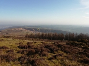
The top take-off of Mynydd Machen.
Flying
This site can experience turbulence in strong winds, and is best flown in lighter winds on all sides. Ridge lift on the NE side can be spectacular – up to cloud base! You have been warned.
There is plenty of bird life around to see. The NE side affords you spectacular views of the Twmbarlwm and Mynydd Y Lan and up the Cwmcarn valley. Flying this side can feel extremely ‘wild’!
The S/SE side give you a view to the Bristol Channel and Cardiff in the distance. Overall this is a magnificent view point.
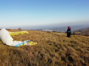
A view of the south and south east side of Mynydd Machen. You can see the distinctive aerial mast on the right of the image. The trees are gradually being removed so that the take-off on the south will be clear again.
Hazards
Trees on the south and south-east sides. Rotor on north-east take-off has also been experience. Avoid the large aerials and buildings on top of the hill. Model aircraft pilots have been known to use the hill – be considerate of them. Horses are found in many of the fields – avoid landing in or flying low over these fields.
Machen slag heap – This has sharp metal objects poking out of the slag, avoid these. The slag heap is a spike back (with severe rotor to be expected behind it) – NEVER take-off here if there is any chance you could be blown back behind it. NEVER fly behind (down-wind) of the slag heap.
Respect others who have a right to be there.
Open site – This site may be flown by suitably insured visiting hang glider & paraglider pilots.
TBC.
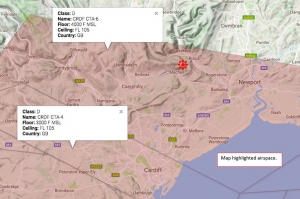
This site is rarely if ever used for XC. The site sits within a 4000 ft airspace limit.
All maps courtesy of OpenStreetMap Contributors.
If you require further advice about a particular SEWHGPGC site please contact a Club Coach. Please report all accidents to The Club Safety & Training Officer Steve Millson and the BHPA. Please visit the BHPA for the most current Incident Report Form.
This document is a guide only.
We advise that anyone Hang Gliding and Paragliding conduct a dynamic risk assessment prior to flying any site. This should be continuously re-assessed due to the changeable conditions of the outdoor environment.
All individuals are advised to take the following into account when making their dynamic risk assessment:
Paragliding and Hang Gliding are dangerous sports that can cause serious injury including bodily harm, paralysis and death. Flying SEW sites is undertaken with the full knowledge that Paragliding and Hang Gliding involves such risks. As the pilot you take exclusive responsibility for all risks associated with your part taking in the sport.
Any liability claims towards the club are excluded.
If you are not sure. DO NOT FLY.
In the Mountains/Rivers/Lakes
Dial 999/112 and ask for the Police and then Mountain Rescue. If you are away from the road side then dial 999/112 and ask for the Police and then Mountain Rescue explaining your circumstances. If you cannot make voice calls, you can now contact the 999 Emergency Services by SMS. NB you must register this prior to an emergency.
In an emergency 999 need to know:
Who is Calling?
Your name and mobile number.
What?
Briefly, what is the problem, including the state of the casualty. Ensure you use the buzzword Fall From Height
and Remote Location.
Where?
Mynydd Machen Mountain 2km South of Crosskeys village near to the A467.
