Status: Open |
|
|---|---|
| Site Latitude: N51.544299 | Height ASL Meters: 250m |
| Site Longitude:W003.280484 | Height ASL Feet: 820ft |
| Wind Direction: ENE - SSE | Height Top to Bottom Meters: 200m |
| Best Direction: E | Height Top to Bottom Feet: 670ft |
| Minimum BHPA Rating Hang Gliding: BHPA CP rating | Member status: Open Site |
| Minimum BHPA Rating Paragliding: BHPA P rating | OS Grid Reference and Prefix: ST 106 836 |
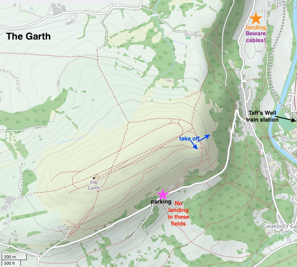
Aim towards Pentyrch and approach the hill from the south-west side to avoid traffic on the narrow road on the west.
Turn right onto the narrow road that runs along the base of the hill, and park in the lay-by at the east end (just before the road starts to go downhill again). It is often easier to approach from the west (Pen-y-garn end) – and not the very steep narrow approach via Gwaelod-y-Garth. This road is subject to subsidence, and is sometimes completely inaccessible from Gwaelod-y-Garth too. Carry up the SE side of the hill (quite steep).
Take-off
Take-offs on Garth Hill offers spectacular views over Cardiff, the Severn Estuary and across to the North Somerset coastline.
There are two take-off areas, South East and East. Access to both is by foot only, a long hard carry up. Beware of rotor behind the East take-off. If the wind is off the hill, expect turbulence from the South East side in particular. The wind is often split as if it comes up from Cardiff and in these situations should be considered a thermic site for launching off on.
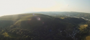
Looking back at Garth hill. The South East side is most prominent in this photo. Photo courtesy of Tom Petith.
Landing
Top landing
The top landing area is quite large and fairly flat. But the steep slope and vegetation on the front of the hill makes paraglider slope landings difficult. You should beware of potential turbulence when deciding where to land. Be careful of walkers, livestock on the top and some of the monuments on the top. If livestock is on the top then stay well away from them and never fly low over livestock.
Bottom landing
DO NOT LAND IN THE FIELD AT THE BOTTOM OF THE HILL ON THE SOUTH EAST SIDE (which is clearly marked on the map). Although this has been tolerated previously the field is under new ownership and to be stocked. The owners specifically request that nobody lands in this field and you will cause considerable upset and problems if you do this. You must use the official bottom landing which has been negotiated by the club.
The official bottom landing field is on the East side, and can be difficult to reach if winds are off to the North. This is especially true for paragliders. Beware of low power cables running through the middle of the undulating official bottom landing field, and along the road. It is recommended you visit the bottom landing field prior if this is your first time at the site. Do not pass gliders over the hedge. Carry gliders out via the farm track. The owner lives in the adjacent farm.
Flying
In an easterly this site has limited capacity, a maximum of two or three gliders soaring at any one time. The site can provide pleasant flying in light evening winds, but in strong winds can be turbulent behind the trees and quarries. The take-off area has a 4000ft air space ceiling directly above it. Further to the west the airspace drops to 3000ft. Be familiar with air space restrictions before flying.
The site can be very thermic with reliable large thermals being generated from the villages of Taff’s Well and Gwaelod-y-Garth below to the east. Thermals are also reliably generated between the Lesser Garth Hill (quarried hilll directly in front and to the south). Looking out for the sea gulls thermalling is an excellent tactic on light wind thermic days as you can just launch straight into a thermal.
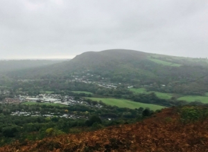
East side of Garth Hill (as viewed from Craig yr Allt).
Hazards
Beware of walkers and cows on top of the hill.
The bottom landing field is tricky, and well worth a preflight visit.
Be especially careful when taking off if the wind is blowing slightly off (to the west of south) as you could be gusted backwards over the east cliff edge of the hill in these instances. You need to ensure there is plenty of distance between your take off and the eastern cliff side if you are intending to take off when the wind is more south or SSW. You must never take-off with a cliff directly downwind of your take-off point if you could be gusted backwards down it and if you are unsure and do not have the required skills then do not take-off.
Do not land in the fields just in front of the parking area, clearly marked on the map.
Open site – This site may be flown by suitably insured visiting hang glider & paraglider pilots.
TBC.
This site is not commonly used for XC and sits inside a 4000ft airspace limit. but good distances can be flown. The nearest train station is Taff’s Well which is well connected with the bus routes too. If you fly XC in a west direction you will probably be best pushing north first to clear the 3000 ft limit; in this direction you will then be faced with a dilemma of flying up towards Porth and the steep valleys and Western Beacons, or tracking near the coast (and sea air) and heading towards Swansea.
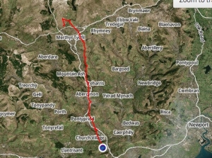
Mark Baldwin officially holds the site record, flying 18.4 km on a marginal blue day up to Gelligaer Common on his Skywalk Spice in a NE direction.
Sebastian Kurosz flew 27.8 km on a Triple Seven King. During a hot, blue southerly day. Unfortunately he infriged the 4000 ft air space limit at Abercynon.
Copyright belongs to Open Street Map contributors.
If you require further advice about a particular SEWHGPGC site please contact a Club Coach. Please report all accidents to The Club Safety & Training Officer Steve Millson and the BHPA. Please visit the BHPA for the most current Incident Report Form.
This document is a guide only.
We advise that anyone Hang Gliding and Paragliding conduct a dynamic risk assessment prior to flying any site. This should be continuously re-assessed due to the changeable conditions of the outdoor environment.
All individuals are advised to take the following into account when making their dynamic risk assessment:
Paragliding and Hang Gliding are dangerous sports that can cause serious injury including bodily harm, paralysis and death. Flying SEW sites is undertaken with the full knowledge that Paragliding and Hang Gliding involves such risks. As the pilot you take exclusive responsibility for all risks associated with your part taking in the sport.
Any liability claims towards the club are excluded.
If you are not sure. DO NOT FLY.
In the Mountains/Rivers/Lakes
Dial 999/112 and ask for the Police and then Mountain Rescue. If you are away from the road side then dial 999/112 and ask for the Police and then Mountain Rescue explaining your circumstances. If you cannot make voice calls, you can now contact the 999 Emergency Services by SMS. NB you must register this prior to an emergency.
In an emergency 999 need to know:
Who is Calling?
Your name and mobile number.
What?
Briefly, what is the problem, including the state of the casualty. Ensure you use the buzzword Fall From Height
and Remote Location.
Where?
Garth Hill 1.5km West of Taffs Well Village to the North of Cardiff South Wales. Just west of the A470.
