Status: Open |
|
|---|---|
| Site Latitude: N51.587116 | Height ASL Meters: 320m |
| Site Longitude:W003.281867 | Height ASL Feet: 1050ft |
| Wind Direction: SSW-WSW | Height Top to Bottom Meters: 60m |
| Best Direction: SW | Height Top to Bottom Feet: 200ft |
| Minimum BHPA Rating Hang Gliding: BHPA CP rating | Member status: Open Site |
| Minimum BHPA Rating Paragliding: BHPA CP rating | OS Grid Reference and Prefix: ST 113 882 |
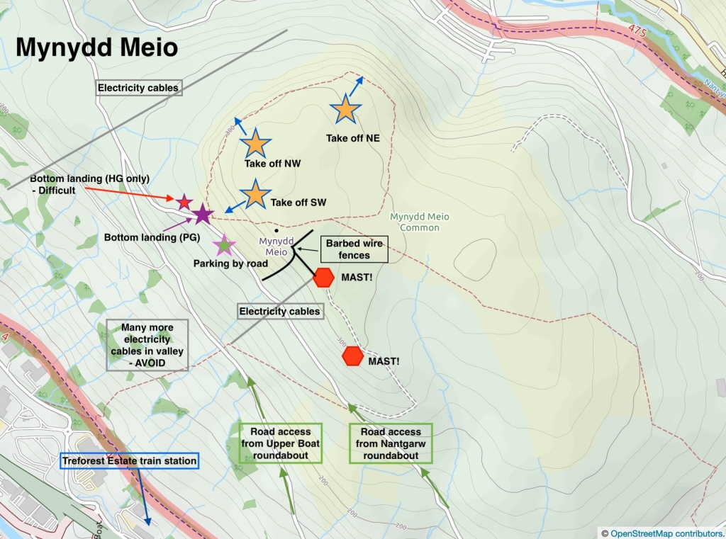
Park off the road at the foot of the hill (in the lay by).
Usually either by minor roads from the A470 – from the Treforest roundabout, or from the Caerphilly road.
UPDATE JUNE 2020 – ROAD ACCESS FROM NANTGARW IS CLOSED – ACCESS ONLY VIA UPPER BOAT ROUNDABOUT.
Take-off
SW take-off: Access to take-off is by foot and is short carry up the face of the hill (up the easily identified path). The preparation area is large and the take-off is friendly.
There is also another path which goes up the face of the hill to the east by the fence – if you end up landing down this end this path may be more suitable.
NW take-off – This is easily accessible by walking up from the road and directly up the NW end of Mynydd Meio.
The hill is not usually flown in a NW wind as significant wind speed is needed to generate sufficient lift to maintain height easily.
NE take -off – This is rarely flown as there are better local options. Access is also from the NW path.
Landing
SW side – The top landing area is extensive and quite flat.
Paragliders can bottom land on the open hill alongside the road (PG landing on map), but there is not enough room to safely land a hang glider there. The emergency bottom landing field for hang gliders is at the bottom of the hill (HG landing on map) to the right of take-off. This field is small and the landing approach difficult, and you should not take-off if there are animals in the field. Please do not fly a hang glider unless you are sure it is soarable, or you possess the necessary skills to land in the emergency landing field. Please do not land in any other enclosed fields, or climb walls or fences.
NW side – The top landing area is fairly extensive and quite flat but because the lift band is narrow you may find it difficult getting high enough again to top land if you drop lower than the top of the hill. There is no defined bottom landing for the NW side so if you cannot top or side land then you may need to fly back towards the NW corner of the hill and land by the side of the road or in the emergency bottom landing field (B).
Top Landing General
South East Wales sites often have very large, undefined take off and top landing areas, which may change position according to conditions. To avoid the potential for collision, pilots making a top landing should keep well away from gliders taking off, who may in some cases have limited visibility.
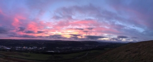
Looking west from Mynydd Meio in the sunset. Photo courtesy of Alex Kennedy.
Flying
Click here for the Cardiff weather station – it can give you useful information, such as whether the sea breeze is coming in and actual wind speeds nearby (but note the wind may be very different on the hill).
Flying here affords you a lovely panoramic view stretching from the Bristol Channel and Cardiff to the Brecon Beacons in the north when the weather is good.
This site can be a good choice if Nanty Moel is busy. It‘s fairly friendly away from the power lines, but the short ridge length and narrow lift band limit the capacity of this site on non-thermic days. Be aware the airspace ceiling is 4000 ft.
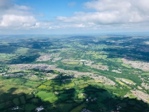
Looking down on the valley towns of Nelson and Treharris just to the north of Mynydd Meio (having come over Mynydd Eglwysilan).
Hazards
Beware of the many power lines and the TV masts. Keep a sharp lookout for model aircraft. Be respectful of the wild horses which live on the top. Be careful of rocks and fences when soaring in close to the ridge. The A470 valley in front of take-off is full of power lines and pylons, pilots should therefore not attempt to fly to the valley bottom.
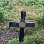
Beware of barbed wire fences surrounding some of the top of the SW take-off. Beware of rocks (visible and non visible in bracken). Ticks are known to be present on the hill. Locate and beware of the cross hidden in bracken in the landing on the SW side (see image right).
If flying the NW side in strong winds then expect wave off the ridge and hills in front (Mynydd Eglwysilan).
The field to the north of the hill is occasionally used for clay pigeon shooting. Do not fly immediately down wind of this field when shooting is taking place.
This site is frequently used by model aircraft pilots, please respect their right to fly as well as your own.
Open site – This site may be flown by suitably insured visiting hang glider & paraglider pilots.
This site can be used for XC and over 50 km has been flown from here. Flying across the valleys in thermals can be a great experience. This site and surrounding area is affected by sea breeze although that can work in favour of XC flying if a convergence line sets up between the Severn and the eastern most hills of the valleys (near Pontypool). The site sits within a 4000ft airspace limit and this rises to 5500 ft after one or two glides. When you do get away you will have the choice of heading further north up into the valleys (with the rising ground) or heading more eastwards for a quicker exit from the valleys system. Once clear of the valleys you will have to track northwards to avoid the river Severn (and any associated sea breezes); so you may choose to stay within the valley system as you head north.
Retrieves from the valleys back to Cardiff are usually straight forward as you can get on the valleys train lines. A train back to Caerphilly train station is generally easy followed by a £10 (2021) taxi to the top of the hill (as there’s a taxi rank at here. Alternatively trains to Cardiff with connections to Treforest Industrial Estate will leave you with a 45 min hike up to the top of the hill.
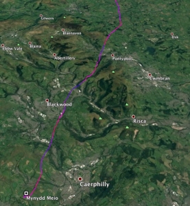
A possible route out of the valleys which Alex Kennedy flew in the hot, dry summer of 2018. (http://www.xcleague.com/xc/flights/20183176.html?vx=37)
Site record
PG – Pawel Barton flew 56.5 km on his Nova Ra on 09 August 2009.
http://www.paraglidingforum.com/leonardo/flight/271581
All image and map rights belong to OpenStreeMap contributors.
If you require further advice about a particular SEWHGPGC site please contact a Club Coach. Please report all accidents to The Club Safety & Training Officer Steve Millson and the BHPA. Please visit the BHPA for the most current Incident Report Form.
This document is a guide only.
We advise that anyone Hang Gliding and Paragliding conduct a dynamic risk assessment prior to flying any site. This should be continuously re-assessed due to the changeable conditions of the outdoor environment.
All individuals are advised to take the following into account when making their dynamic risk assessment:
Paragliding and Hang Gliding are dangerous sports that can cause serious injury including bodily harm, paralysis and death. Flying SEW sites is undertaken with the full knowledge that Paragliding and Hang Gliding involves such risks. As the pilot you take exclusive responsibility for all risks associated with your part taking in the sport.
Any liability claims towards the club are excluded.
If you are not sure. DO NOT FLY.
In the Mountains/Rivers/Lakes
Dial 999/112 and ask for the Police and then Mountain Rescue. If you are away from the road side then dial 999/112 and ask for the Police and then Mountain Rescue explaining your circumstances. If you cannot make voice calls, you can now contact the 999 Emergency Services by SMS. NB you must register this prior to an emergency.
In an emergency 999 need to know:
Who is Calling?
Your name and mobile number.
What?
Briefly, what is the problem, including the state of the casualty. Ensure you use the buzzword Fall From Height
and Remote Location.
Where?
Mynydd Meio Mountain East of the Upper Boat roundabout off the A470 (near Treforest Industrial Estate).

